
How to Identify Faults in the Field? & Purpose of Detecting
Surfaces formed as a result of the pressures exerted on each other by rock masses movements on the Earth in a certain direction as “cracks” (joints), and if there is a significant movement of the masses around them, we define these cracks as “faults“.
The term “fault” was first used in the late 18th century by Scottish geologist (physician, natural historian, chemist, agriculturalist) James Hutton (1726–1797), known as the father of “modern geology” in some circles. The word “fault” originated from the Old French word “faute” which meant “opening, gap; failure, flaw, blemish; lack, deficiency” was first used in the late 13th century, thought to be derived from Vulgar Latin word “fallita”.
In this article (#01), we begin the series of examining faults through an example in the field. Detailed content on identifying and interpreting faults and structural elements in the field, drillholes, underground and open pits will continue.
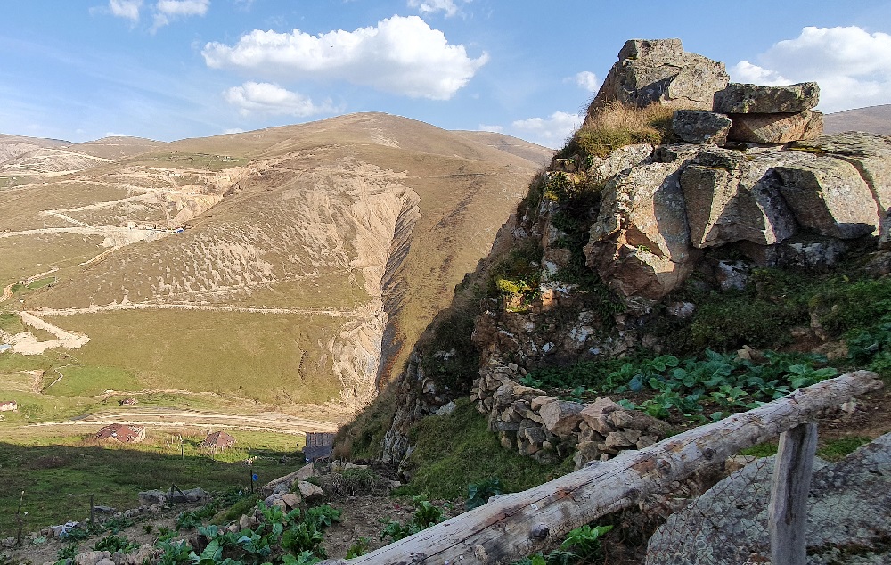
It is quite possible that you can detect pieces or blocks belonging to a mineralization cut and slipped by the fault “C” in the accretion “B” or in the subsidiary structures “A”.
Do not plan drillholes by measuring the direction/dip of these structures in accretions or wedges.
Make deep cuts and slopes until you get away from all structural elements related with the fault zone and make your plan based on accurate measurements. Otherwise, you can find everything with the drillholes you planned, but you cannot find the “mineralization you are looking for”.
Additionally, you can explore the related articles listed below.
The movement of blocks that travel a distance laterally and/or vertically relative to each other in 3 dimensions is the term we call as “slip”, “displacement”. As a result, the use of the term “fault” instead of “crack”(joint) is determined by the presence of a “significant” slip, as it is possible to observe a slip of a few centimeters or “hundreds of meters”. Simply put, the amount of slip that will cause you discomfort or anxiety in your mineralization will constitute a “fault” for you.
Faults generally consist of a collection of approximately parallel fracture surfaces tending to form beams rather than a single plane, and we use the term “fault zone” to describe all of these by grouping them. The block that lies above the dip direction of the fault surface is known as the “hanging wall“, and the block below it is known as the “footwall“. Faults are places where many metal and mineral resources are located. All mineralizations and energy resources have been cut and thrown by multiple faults until today, and this frequently poses a problem in our mineral exploration and production activities. We must determine the faults and other structural elements very well in the field, obtain clean data and interpret them correctly.
Fundamentals of "Fault"
You hammer a stone lying on the ground with a geologist’s hammer, you were successful and the stone is now in 2 pieces. Let’s call the surface where the pieces are separated a fault, and assume that the small pieces still clinging around the surface where the separation occurs are cracks. When we compare this phenomenon with the plate movements on the earth, we see that the rocks cannot stand apart, so they only shift in different directions relative to each other.

We can witness the penetration of hot waters containing carbonate and silica minerals and metal-dissolved acid into the gaps formed between the displaced rocks. As a result of this geothermal activity, which lasts for “tens of thousands of years” until it closes itself like “encrustation”, we can observe ore enrichments in the faults and nearby cracks. In addition, the minerals in the water transmitted to the sea floor through the channels formed by these faults can precipitate and form metal accumulations in layers. These events, which describe enrichment through faults, describe the “primitive” formation of the vast majority of the precious metal resources on earth.
Why Are Faults Important for Mining?
It is inevitable that the mineralizations formed through faults will be replaced by ongoing younger faults, even if the enrichment ends, since they are in the region where active tectonics prevail. In fact, ongoing block movements during mineralization will also affect the geometry of the mineralization. Therefore, it is of great importance to master all structural elements such as faults in order to both imagine the current location of your mineralization and develop the potential around it.
The majority of ancient mine discoveries have been made through mineralizations that somehow reveal themselves as a result of fault slips or show oxidation products. The ancients followed the fault both to facilitate progress in the rock loosened by the fault and to reach the ore body in the passive fault, which was likely to have been cut by the old active fault, in the shortest way. Knowing this or not, they kept an ancestral tradition alive. It is necessary not to accept every fault entry as a “successful” mine.
Along fault surfaces, strikingly colored oxidation products of deep mineralization can be carried to the surface by meteoric waters. It is important exploration data and can allow you to obtain anomalies in many geochemical sampling results such as stream sediment. In this regard, of course, structural elements should be evaluated together with the most accurate methods.
Water always finds the easiest path forward. When the water content due to porosity and permability in the rock finds a fractured surface such as a fault, it will move towards these fractures from all directions with all its strength. Mining operations that are below the groundwater level will face another problem as all the water stored in the surrounding rock will increasingly be collected into their operations. Sometimes, this situation can also cause the levels of irrigation water wells in the region to decrease.
It is very important to find the ore body or coal mass in the place you planned during the production or in further exploration phases. Faults can hide the mass in an unpredictable place, either individually or with periodic slips. It may waste your time.
By the deformation in the rock structure along and around fault surfaces, the ground is generally soft and weathered. Sliding and ruptures due to unstable and loose ground along the fault surface in underground or open cuts are common problems. Positioning and predicting these during the exploration phase will always make the operation and production more durable.
Especially in coal mines or other mines which operates with underground block caving methods, production corresponding to faults in invisible underground open spaces can pose serious dangers both for the underground and surface. An important article on this subject will be published on our website in the near future.
How Should We Mark up the Faults and What Should We Pay Attention to?
Below, we will examine our field observations notes, which are the main subject of this article about faults. Notes on recognizing and interpreting faults and structures in the field, drillholes, underground and open pits will be added also in forthcoming articles related to individual subjects.
- On your map, mark the points where you see the fault intersecting with the surface. If you have morphological data beyond prediction for the places you estimate under cover, mark them. The best map is the simplest map, do not scribble.
- Making maps or keeping records can be done by many personnel. It is essential that these be done as if they were produced by a single source. Structural elements that should not be defined as faults may unfortunately be interpreted as “faults” and recorded in your database as “inconclusive detections”. There are indeed correct faults among these records. But when it comes to examining the data, there will always be a question mark in your mind (I wonder if this really exists?). You must set your standards in order not to have doubts about the “data” that is the result of a large team, spent resources, and months of effort.
- Not every exploration team will have the chance of returning to the same place and checking the same field work again. Do not enter data into your map that you are not sure of below a certain level of reliability. You should follow a certain systematic approach when recording data, and your recording should have a purpose.
- In the past, you could create true or false concepts by interpreting lines in 2 dimensions on large-sized paper printouts. Don’t waste paper and ink, it creates a lot of dust, it’s hard to store, and most of the time it’s hard to remember why you’re printing. Examine in 3D on computer and large screen (maybe LED TV screen), include topography and morphology, paleogeography and geological timeline. Don’t waste paper anymore, don’t be lazy, solve the puzzle with the whole team, you’ll get used to it in a short time, it’s quite fun. In this way, you will determine why you will take measurements and how you need to obtain data.
- Include drillholes in 3d and core photographs in your project work as stated above. The aim here should be to reveal the structural elements in your field by examining all the data in 3 dimensions and making the analogy.
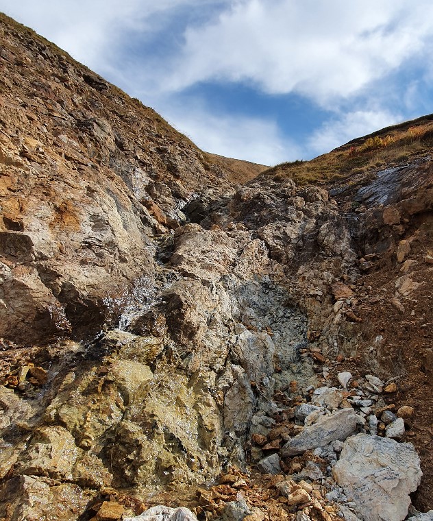
- Along the fault surfaces, meteoric waters can carry oxidation products in striking colors belonging to deep mineralization to the surface. Since the water will transport along the creep or wedging surfaces, the directions you will obtain will not be the real ore direction. For this reason, before taking strike-dip measurements in these areas, make sure you find fresh and stable rock. It is quite arduous, but what needs to be done is to make deep cuts into the fresh rock. Otherwise, you may find everything with the drillholes you plan based on these measurements, but you can not find the mineralization you are looking for. On top of this, it is quite possible that there is an ore body that you abandon as a result of disappointment, not realizing that you missed it.
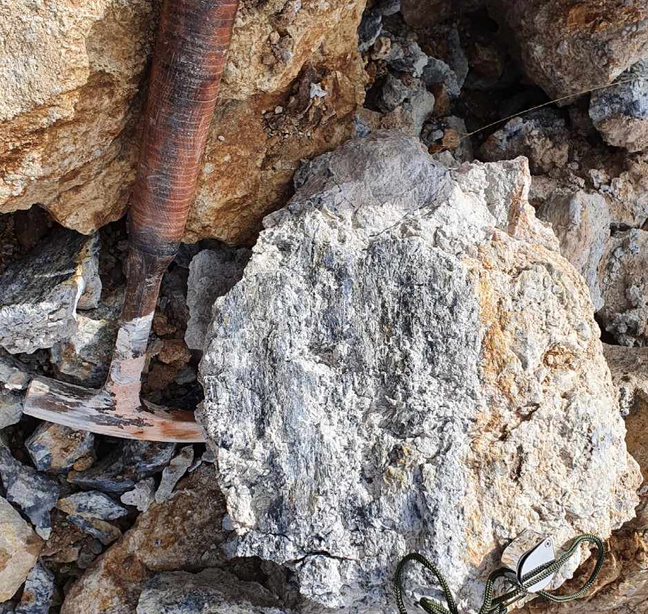
- You can observe many surfaces along the fault-related creep or wedging surfaces. These may have partially cut away the ore bodies or contain pieces of them in the landslide or accretion. You should make sure before measuring the actual directions, it is important to have an experienced eye or a clean and clear surface.
- Rather than spending too much time in the field, aim to see “big data” together on the computer with the team. Take plenty of photos from every angle, take accurate measurements, set and comply with standards, and if necessary, get help from experienced experts for all of these.
Subjects discussed in this article may overlap with your mineral exploration, modeling, mining operation and business development issues and may provide solutions for those. However, remember that various factors specific to your business may bring about different challenges. Therefore, seek support from expert consultants to evaluate all data together in order to convert potential into profit most efficiently.
Should you have any questions regarding the articles or consulting services, please don’t hesitate to get in touch with us.

GMRTC Mineral Exploration & Modeling & Operation Consultancy
Istanbul - Izmir - TÜRKİYE
SITE MAP
CONTACT US
Before quoting or copying from our site, you can contact info@gmrtc.com
All elements (texts, comments, videos, images) on the GMRTC website (www.gmrtc.com) are the property of GMRTC unless otherwise stated, and are published to provide insights to interested investors, professionals, and students. Any detail that may arise during your process will affect the subject matter you are interested in on this website; therefore, GMRTC (www.gmrtc.com) is not liable for any damages incurred. It is recommended that you consult experts with all your data before making any decisions based on the information provided.