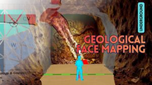
Geological Mapping in underground operations refers to the systematic documentation of all geological features exposed on the face and accessible surfaces created by unit-scale tunnel advance, recorded in scaled form.
Qualitative and quantitative observations—such as lithology, alteration, ore–host rock contacts, faults, and fracture attitudes—are transferred onto paper or digital media and archived in accordance with established standards.
It is carried out by a team that actively follows the mining process and, based on the results obtained, provides the necessary guidance and warnings prior to advance or planning.
Unlike conventional geological mapping conducted at the surface, it represents the continuous and standardized two-dimensional projection of a three-dimensional geometric volume.
2. How Are Underground Geological Maps Made?
Before mapping of an underground advance, first fulfil the requirements of your occupational safety procedures; remember that during mapping your attention will be on the exposed surfaces, making you more vulnerable to hazards.
Stand on the imaginary line marking the start of the advance, position yourself centrally by observing the sidewalls, aim toward the center of the face, and determine the mapping direction by measuring the heading with a compass.
Define imaginary bounding lines of the face, sidewalls, and roof so that each represents an absolute quadrangle; measure or reliably estimate the edge lengths forming these boundaries and plot them on the map.
If the advance requires support, maintain a safe distance; if not, approach the face and sidewalls and use a hammer to distinguish lithological and structural elements on accessible surfaces.
Visually trace lithological boundaries along their strike; using the corner points of the surfaces as reference, first mark points on the previously drawn edges and then connect them.
Number the structural elements you have drawn, measure their orientations with a compass, and record all associated attributes in the relevant table.
Depending on methods defined specifically for the operation, visually acquired data may be converted into numerical counterparts and used for monitoring gallery stability.
It is important to note on the face map and in the accompanying description any natural or artificial features intersected during the advance—such as water discharges, and elements related to operational or exploration activities.
If you foresee any unusual conditions that may affect subsequent steps or shifts in the operational workflow, you may note the necessary precautions or facilitative remarks and complete the mapping.
3. Importance of Advance Geological Face Maps in Underground Excavations
The advance face will soon be covered due to support installation or dusting. The data mapped and recorded by the personnel—likely observing the exposure for the last time—holds archival value.
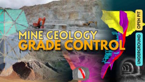
Mapping is the most detailed record of the orebody and forms the basis for grade control studies. It provides unique advantages for resource model updates and for ensuring the reliability of mineral reserve estimation.
It enables you to track the potential in the upper and lower levels and adjacent zones of existing workings without missing opportunities, and allows you to identify in advance any fault that may pose operational challenges.
In summary, a reliable, standards-compliant mapping archive guides planning and production while providing a framework for monitoring mining efficiency and operations.