With the advancement of software technology, we can now easily and quickly analyze and visualize mineral resources in three dimensions. This capability enhances our ability to understand and interpret geological data, facilitating informed decision-making in exploration and resource management. As we gather more data during exploration and production, we update these models to better reflect reality. This allows us to quickly share insights and make informed decisions about mineral deposits. Using models helps us communicate clearly and seek expert advice remotely, streamlining our planning and achieving results efficiently.
Drillholes are planned and carried out to determine the entry and exit points by penetrating the ore body that you believe to be underground with a “good guess” and to obtain grade/quality data in this range.
Drilling cores are examined thoroughly and data are recorded at specified intervals.
Ranges with ore potential are sampled based on the recorded data.
When the results come, you can move on to the “ore modeling” phase.
When taking action with the data at hand, the largest surface of the ore body is gridded.
The first group/program of drilling targets the most valuable part of the expected ore body.
The first program is performed at as wide intervals as possible. These drillholes are “exploration drillings”.
While drillhole target distance may vary based on mineralization type and size, exploration drillings are typically conducted at distances of approximately 100 meters or more on the grid of the ore body.
Within the scope of the machine park and possibilities, the target plate grid is expanded from the center to the outside as the economic grade is intersected and tested with drilling.
Infill Drillings: These are the plans carried out in such a way that the distances between the first group of drillings that have economic value are reduced to 25 to 50 meters.
Making the best exploration drillhole planning will allow you to save time and resources by eliminating the need for new locations for intermediate fill drillings.
This topic includes many elements that require order and discipline, so remember that the system to be installed in your coreyard will directly affect the reliability and validity of your final product “model”.
Figures indicated by resource classification (JORC, NI 43-101, UMREK) and category (RESCAT) are the interpretations of earth science professionals reporting/modelling. Stay tuned for our posts regarding reporting, report reading and investment evaluation suggestions.
2. What does ore body modeling mean?
To accurately reflect the underground mass, of which we can estimate the coordinates and/or content within its boundaries, in a three-dimensional environment.
At least three points define an area, which we can determine through drillholes or other samplings. By creating volume for the concerned mass with these triangles, we can initiate our estimations, and as we continue to acquire data, we can update these boundaries with new points to approach reality.
The ore model is an interpretation by mining professionals and does not imply certainty.
The modeler’s mastery of relevant ore formation dynamics and structural geology is crucial for the model to approach reality.
During excavation, monitoring production and collecting data with accuracy is also crucial. Planning offers unique advantages in preventing discrepancies between mine and process grades.
We can categorize modeling into two main types: solid model (wireframing) and block model
3. What is a "Solid Model"?
The three-dimensional representation of the boundaries of the underground ore mass, which we define as the volume we have not yet seen or already excavated, is referred to as a solid model or wireframe.
In a way, we can liken it to a shell.
Models of faults and low-strength lithologies around mineralization can also fall under this definition.
Production plans for mine planning purposes are also considered solid models.
3.1. Why is the solid model necessary?
To visualize the underground mass and its continuity, which we assume to be ore boundaries, a solid model is essential.
It is a prerequisite for the block model, as it is the model we will fill with blocks.
We can use models of faults and low-strength lithology around the mineralization for both production and occupational safety purposes, taking precautions and planning while considering such hazards.
Additionally, it can be used by the geosciences team to provide more detailed information with the most up-to-date data for short-term production planning.
3.2. What are "Explicit model" and "Implicit model"?
When defining ore boundaries (solid model), the explicit model is created by manually placing points on drillholes and logical (justified) locations, adhering to reliability and simplicity.
When we allow ‘the rapid and skillful approach functions of software developers’ to add numerous extra points to smooth these points and surfaces automatically, our model becomes implicit.
In the video, you can distinguish the volume difference between the implicit and explicit models created from the same drillholes through color-coding.
IMPORTANT: The concept of the implicit model was not as proficient in the early stages of modeling automation evolution as it is today. Initially, models that produced shapes resembling ellipsoids and were referred to as shells were considered inadequate by authorities for resource estimation. However, software developments have made it possible to terminate and continue volumes with faults, logically continue surface inclinations, and achieve faster and more reliable results than manually created models. With artificial intelligence’s increasing understanding of nature, the concept of ‘implicit’ will soon become crucial for modeling and reporting.
4. What is a block model?
A model in which we can obtain data at any criterion we want at any or more points of the mass within the solid model.
We assign this data to those points by developing “predictions” based on the samples we take.
Although the data we want is generally grade (ore quality), it is possible to calculate many numerical data or assign alphanumeric data specific to your business, from lithology to rock strength.
Let’s go into a little more detail.
The solid mass is filled with cubes (actually rectangular prisms) of optimum dimensions.
We know the dimensions of these cubes and their representing center points with their coordinates in 3 dimensions, so we can also calculate their volume.
We can now define data to the center points of these cubes representing unit volumes.
By using a function for each point (i.e. block), we can develop and save predictions based on sample results with known coordinates.
You can calculate the ore mass you want to produce or have produced in seconds by bringing together the blocks (points) you want, whose volume and the values representing this volume are known, using a weighted average.
4.1. Why is the block model necessary?
Briefly, for resource and reserve reporting, mine planning, production tracking, and grade control purposes.
By designing models and estimates for criteria such as geotechnical, metallurgical, lithological, and rock strength according to your objectives, you can facilitate your business.
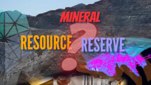
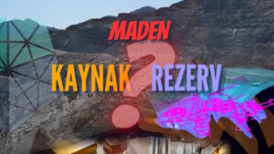
4.2. What is the resource or reserve model and what does it do?
With the block model you will create or update, you can develop long-term mining production plans and provide reliable statements (reports) for project acquisition, as well as investor/shareholder information.
It is a block model created with all the systematic samples you took during drilling, exploration and production, with which you can calculate the tonnage and grade (quality) of ore that can be produced from your project.
With the block model you create or update, you can create a long-term mine production plan and provide reliable status reports for project buying and selling and investor / shareholder information.
Details such as resource model creation, drilling frequency, data acquisition reliability standards are determined according to the reporting codes/rules you will use as a basis.
Having an experienced geosciences professional who is familiar with the end product “modeling and reporting” review your drilling plans from the beginning of the exploration project will be very beneficial in every aspect for the future stages.
The reports required for the listing of companies on the stock exchange and public disclosure notifications, and the models from which the source data to be published therein are obtained, must be created by earth science professionals whose competence is recognized by the stock exchange institutions.
Suggestions on what to pay attention to when reading and evaluating these reports, which are extremely important especially in terms of making decisions about investments, will be given in our future posts.
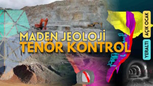
4.3. What is the grade control model and what does it do?
It is a block model that helps to suggest/assign grade values to stockpiles whose production has been completed and kept for process or sale, by constantly updating the grade control program through regular pre-production sampling representing a certain volume in the underground or open pit.
You can calculate tonnage and grade with the blocks of the grade control model falling into the solid model that will represent the production in question.
In this way, you will instantly have tonnage, grade/quality information about the ore in your stock area during the process.
The grade control model is the model that best represents the ore and structure found in nature, as it will have the most frequent and reliable sampling and mapping data.
“The closest model to the real thing is the model that has been produced.”
In addition to on-site observations (in the field or underground) by the professional creating the model, knowledge of relevant mineralization dynamics and structural geology is crucial for making the model more accurate.
Figures indicated by resource classification standards (such as JORC, NI 43-101, and UMREK) and categories (RESCAT) are interpretations by earth science professionals who report and model these resources. Stay tuned to our social media accounts and website for updates on report creation, reading, and investment evaluation suggestions.
All elements (texts, comments, videos, images) on the GMRTC website (www.gmrtc.com) are the property of GMRTC unless otherwise stated, and are published to provide insights to interested investors, professionals, and students. Any detail that may arise during your process will affect the subject matter you are interested in on this website; therefore, GMRTC (www.gmrtc.com) is not liable for any damages incurred. It is recommended that you consult experts with all your data before making any decisions based on the information provided.